Day 17: Flekkefjord harbour – Tavanger Marina – 75 nm
We had a short weather window with not optimal conditions to round the south-west corner of Norway. We left Flekkefjord at 9:30 h and motored against the wind during the whole trip. The Fjord was calm and nice. We saw a salmon farm on the exit of the fjord. The fish were all swimming in a great circle following the round cage formed by a big net. They were continuously jumping out of the water as if someone was chasing them. On the open North Sea we were faced with some old swell that made our lives miserable for most of the day. Kirsten went under decks to lie down while I spent all day in the cockpit to check the course. I had put on all I had: Fleece trousers, jumper, scarf, cap, foul weather gear, sailing boots and watertight ski gloves. I still was freezing. The rain let us feel even less comfortable.
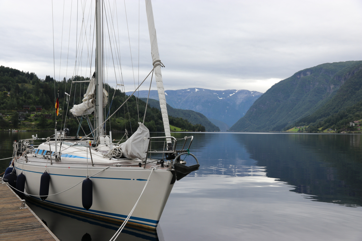
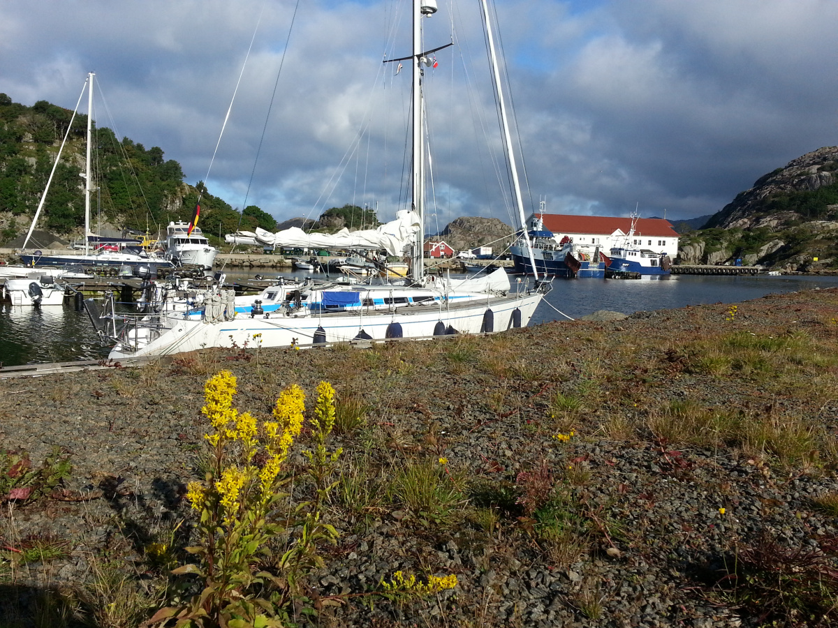
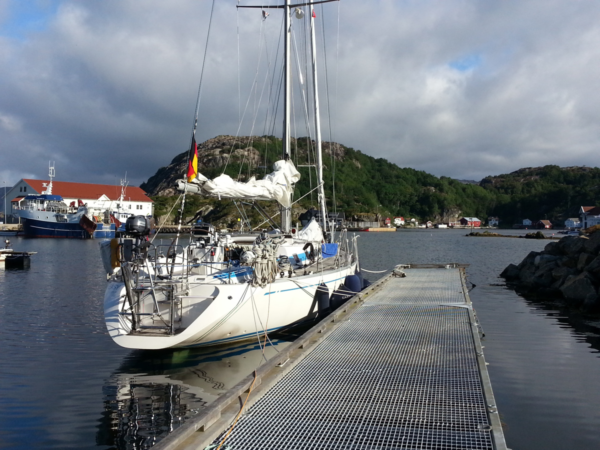
Finally we could turn right into the calm harbour of Tavanger. Berthing was easy. A nice Norwegian guy showed us a berth wide enough for EASY. If he had not dropped our elastic plastic pipe protecting our front lines into the 10 m deep harbour everything would have been perfect. His wife was away and he must have not spoken to anyone for days so we could hardly find the time to fasten our lines so busy he was telling us all about sailing and his adventures during the past years.
Day 18 – Bus Trip to Stavanger, Ferry Trip to the Lysefjord and Visit of the Petrol Museum
Since a lot of rain was forecasted we chose to stay a day in Tananger and went on a touristy trip to Stavanger. With a lot of luck, we caught a bus within 2 minutes, went straight down to the catamaran ferry terminal and got right on the boat 10 minutes before departure. The speedy boat took us to Preikestolen, a high plateau, some 600 m above the water. We saw seals, a large waterfall and the ferry landed at a spot where some goats had gotten used to visitors and were fed with carrots off the ferry. It rained a lot and the clouds were low and dark. We got an impressive idea of the fjord landscape. Back in Stavanger we visited the Petrol Museum and learned all about Norwegian oil production which had started 50 years ago and had led to the extraordinary wealth of the country.
Day 19 – Tavanger Marina – Bømlo Island, Langevag harbour – 45 nm
We spent most of the day sailing in mild conditions. The first 6 miles we escaped a thunderstorm that followed us in parallel over land. We turned on the radar to watch the movement of the squalls in relation to our position. Then some hours of sunshine reminded us briefly of the actual season of summer. Later, in the Haugesund another thunderstorm approached and we took down the sails to be on the safe side and motored along the rocky coastline. We passed one of the areas with potentially dangerous waves but the sea was flat and we had an easy passage despite of the now continuous rain.
Day 20: Langevag harbour – Northeimsund Guest Ponton – 59 nm
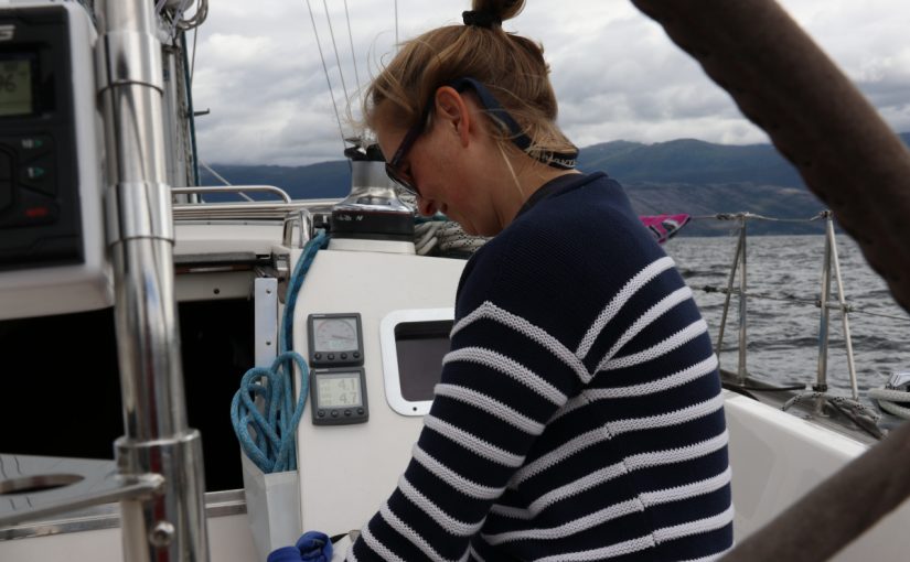
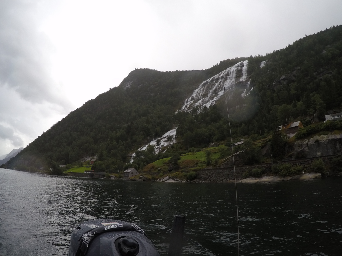
Next morning, we found a bag with four fresh rolls as a surprise of the harbour master. This gesture is a good example of the friendliness of Norwegian people as we experienced on every occasion so far. We had a late start as usual and sailed in the changing winds of the fjord. We started in the second reef of the main and with the jib in gusty winds around 18 knots. Later we could take out the reef and use the genoa.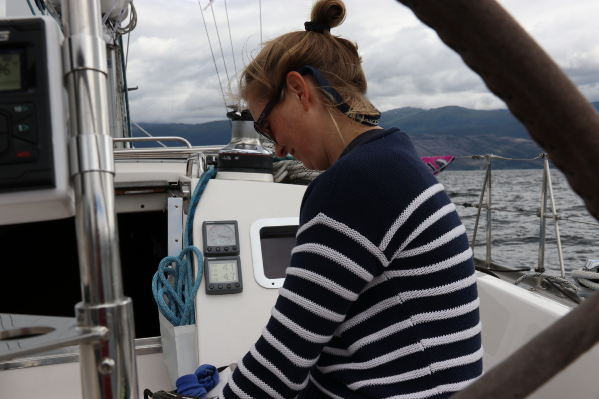 Finally, the wind died and we started to motor. I tried to catch a fish but did not have any success so far. We saw the first snow on the surrounding mountains and some tall waterfalls on the sides of the fjords.
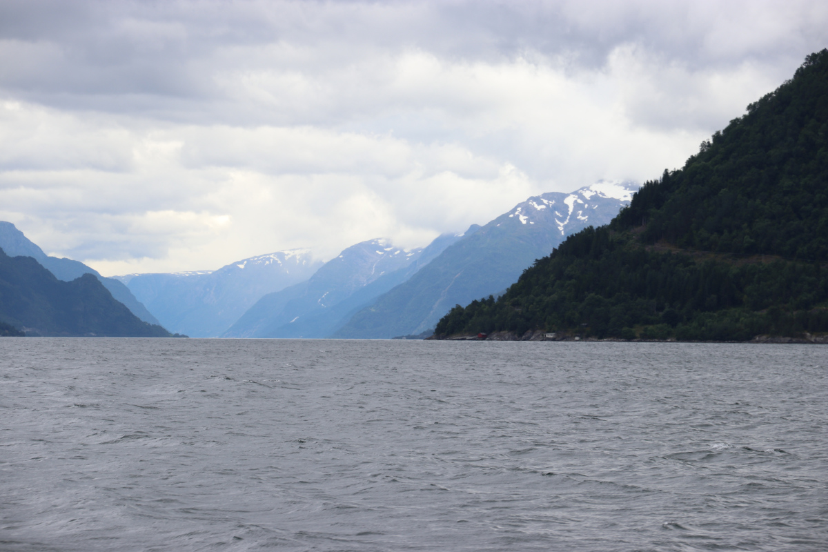
 Then we passed the Bondesund and the wind was blowing through the sund like through a funnel. The direction was 90° different from the normal wind direction.
The trip took us further northeast through the Hissfjorden ind into the Ytre Samlafjorden. Each segment of the Hardangersund has its own name. We turned left and entered the quiet waters of the Northeimsund. It would have been easy to find an anchoring spot but Kirsten is always happier when she can walk for a while after we have reached a harbour.
Day 21: Northeimsund – Ulvik Ponton, 39 nm
In the morning we spent half an hour to find out that the diesel fuelling station did not work. We must have tried every combination and sequence of steps but failed to retrieve a single drop of the high quality Norwegian liquid of wealth. Our tank holds 255 l, so there was not really anything to worry about. The rest of our diesel would be enough if we had to motor all the way out of the Hardanger. After leaving Northeimsund we turned left into the narrow Fyksesund.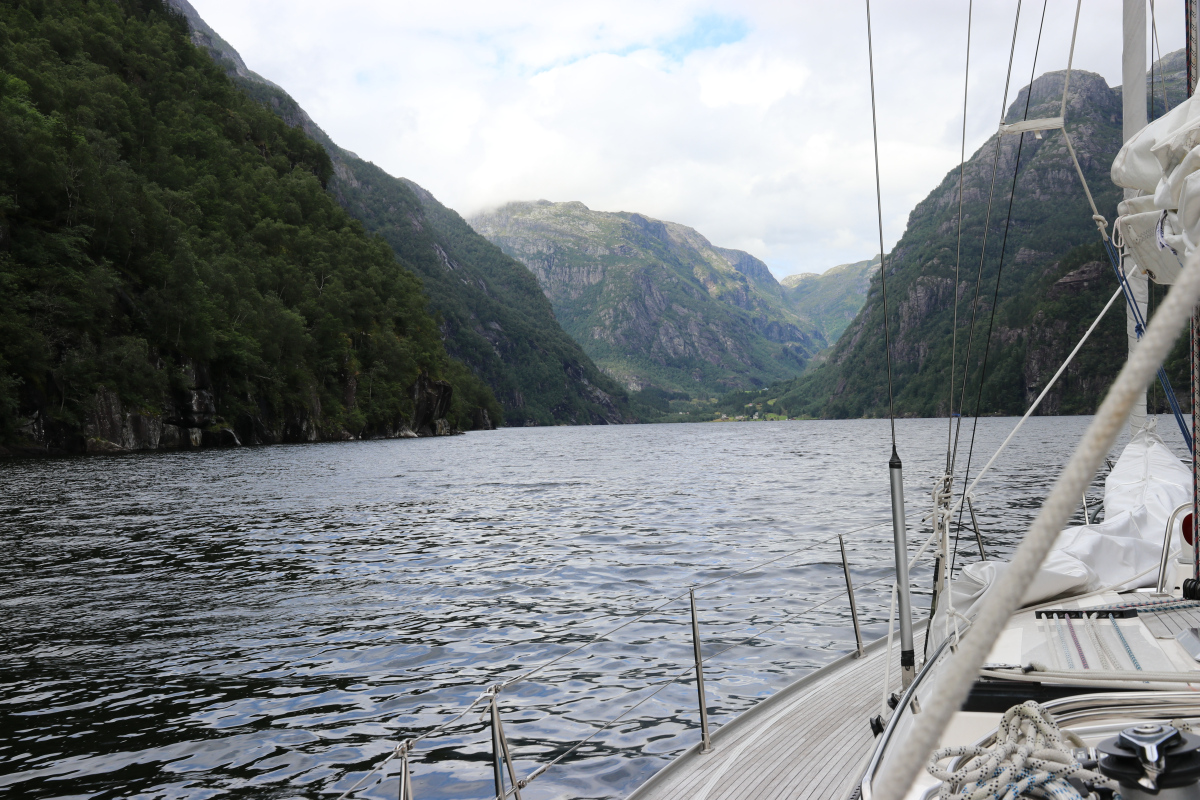
 While the bridge close to the entrance was 26,5 m and certainly high enough for us, the power line in the middle of the sund puzzled us. The map showed 56 m of height. A yellow sign at the line said 20m. Our mast has a height of 19 m. We sailed to the side, where the lines were highest and passed with no problem. My estimation of the height of the wires is about 30 m in the middle, lowest point. The sound was very quiet, despite two motor boats, towing children in a small dinghy at planning speed. On this day, we still could not reach the end of the Hardanger, so we choose to enter the Ulvikfjord. Ulvik is a small village at the end of the Ulvikfjord.
  We were the only sailing boat and should not see another sailing vessel for several days from now on. We found a nice spot on a swimming pontoon next to the ferry dock with water and electricity, no diesel.
After arrival we were visited by a group of Chinese tourists. They liked our ship, and two teenagers, Frank and Vera and their respective families had a closer look at EASY. The screens of our chartplotters were still on and were of special interest to them. A lot of photos of us and of EASY were taken.
Ulvik was totally destroyed with the exception of the church, by German troops in 1940. The troops had previously been attacked by the Norwegians when they landed in Ulvik. Today, it is absolutely not to understand for what reason the German troops invaded this remote part of the world and produced such a tragedy.
Day 22: Ulvic ponton – End of the Hardanger -Sørfjord – Odda Harbour – 52 nm
The wind was below 5 kn for most of the day so we had to motor to reach the end of the Hardanger, which is the Eidfjord.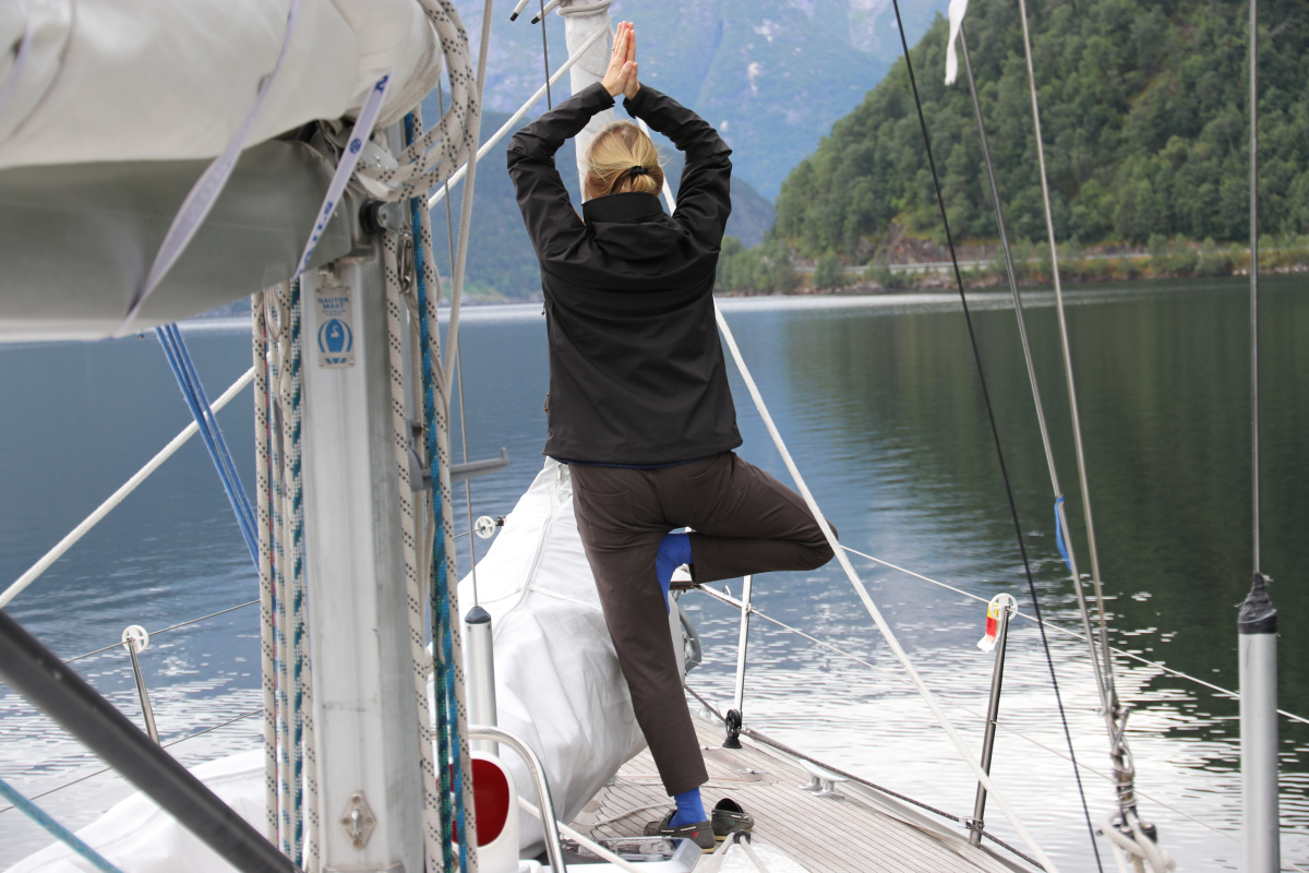 In the Eidfjord, the water was greenish blue and had an opacity known to us from mountain lakes.
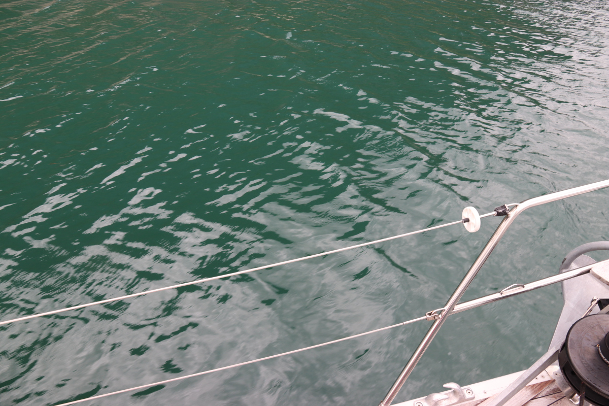 The mountains surrounding the Eidfjord were steep and high and we got used to snow on the mountain tops by then.
 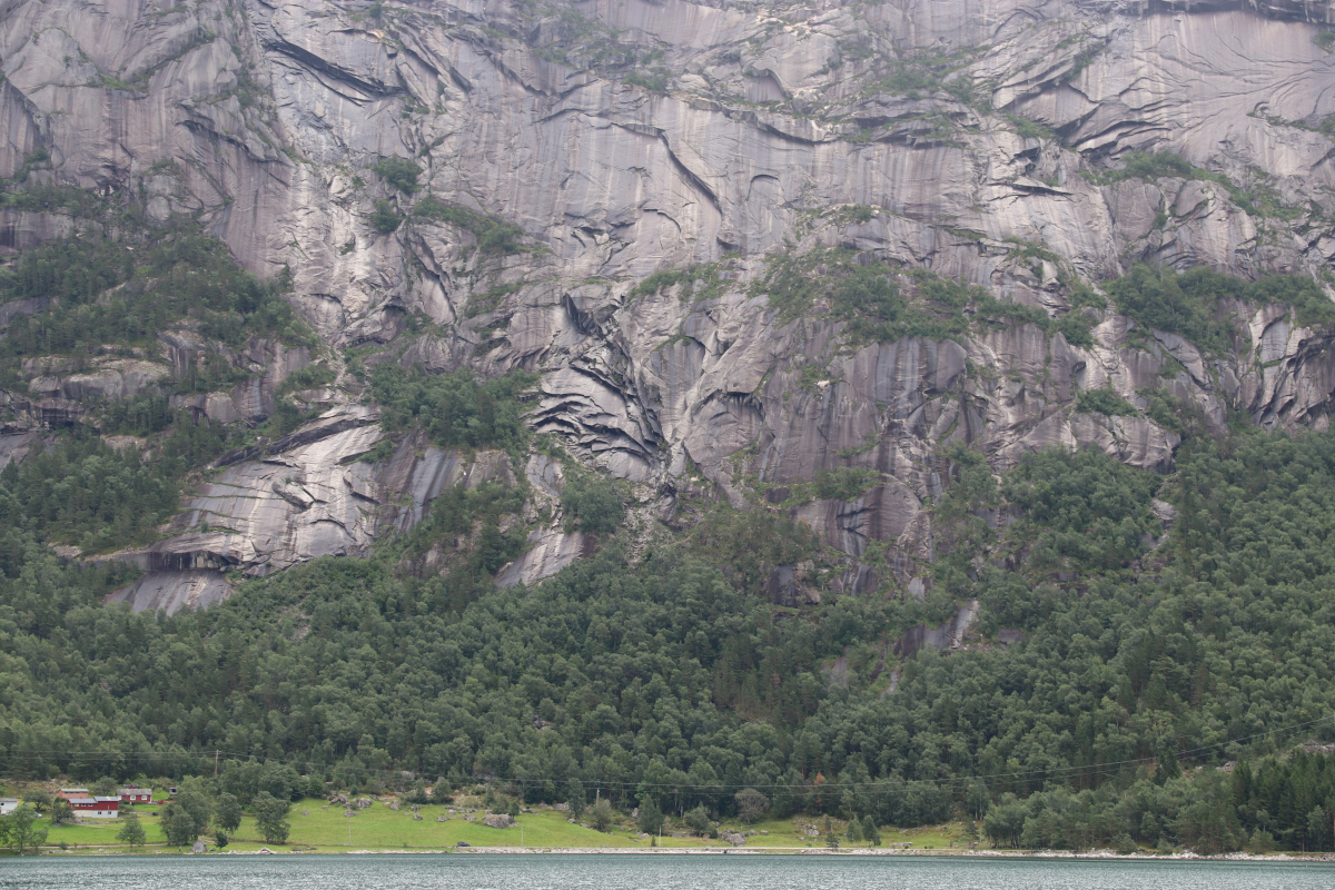 We watched some high waterfalls.
 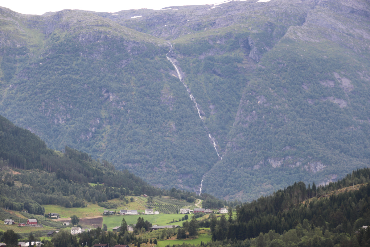 The Norwegian word for waterfall is fossen which nicely describes the sound being produced by the falls that is noticeable over a long distance on the sound. On Entry of the Sørfjord we got into a storm front with heavy rainfall.
Kirsten had baked a cake, which turned into a brick of coal in no time and left a smell in the ship that reminded of a fire on board and which stayed with us for several days.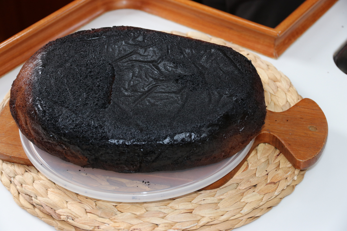 After she cut off the burnt part, the cake tasted well, although I secretly added some sugar to match my taste.
The rain weakened and it was a unique experience standing in the dribbling rain, giving way to the Jondal Ferry, with the accurate rows of apple trees on the green, gentle slopes on the left side, and the snow fields and the glacier in front of us, partially covered by rainclouds.
Later the wind increased to over 25 kn and we had to motor directly against the wind. We had planned to anchor in a small bay behind a reef but due to the wind blowing directly into that bay we decided to head on to the end of the fjord and stay in the city of Odda. I had already inflated our dinghy on the foredeck to give Kirsten the chance for an evening walk on land but I had to deflate the dinghy in the spray of the waves after we had changed plans. Still, the passage of the Sørfjord was well worth the effort since here the views of the Folgefonna glacier were most spectacular. The hills were steep and the fjord is narrow. Several waterfalls starting at the glacier and reaching into the fjord dominated the scenery. It was getting dark when we passed Tyssedahl, a few miles north of Odda. There was a factory blowing burning fumes into the dark sky. Also, al lot of steam was produced. We learned later, that this was one of the wolrdwide five, and the only European titanium smelter where also pigment was produced. Also an historic power plant with interesting architecture which is now a museum, was illuminated just as we passed it. In continuous rain, we reached Odda, had our evening meal and went to bed.
Day 23: Odda – Granvin pier – 35 nm
The picture shows the Hardanger Hotel in Odda, in the rain.
We spent the morning walking around in Odda in the dribbling rain. Odda is dominated by industry. It also serves as the starting point for hiking tours to a mountain with a unique rocky formation called the Trolltunga since it looks like a tongue horizontally stuck in the air.

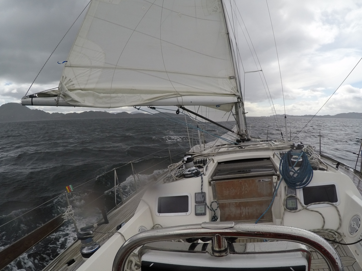
We left Odda without using the motor, sailing down the Fjord with the Genoa. We spent the next hours with endless gybes and intermittently had to use the engine due to the continuously changing winds. The wind speed varied between 3 and 33 knots due to the funnel effect of the narrow fjord. Again, the views of the waterfalls were were very impressive.
When we rounded the cape at the exit of the Sørfjord everything changed within minutes. We passed a line of steep, braking waves due to a sharp change of currents and found ourselves in 20 kn of wind, waves up to 1,5 m, and current against us. We could just maintain a speed of 1,5 kn under engine. After two waves had washed the whole deck and cabin of EASY, even entering our not firmly enough closed window, we had to decide to turn and head into the nearby Granvin fjord. As we learned later, this was a mistake.
We were making 4 kn without sail with the engine switched off when I discussed the situation with Kirsten under deck. When I got back in the cockpit I noticed the nearby Norwegian Coastguard (Kystvakt) vessel heaved to next to us to check why no one was on deck. They turned and disappeared when I furled out part of the Genoa to sail into the fjord.
Our harbour guide mentioned a new wooden pier in Granvin why we decided to enter this fjord. Our Diesel was reduced to 40 l so we did not want to lose our gain towards the exit of the Hardanger and chose to enter the Granvin Fjord although the direction of wind and waves was straight into the fjord. The entry into the fjord was exciting with green water and breaking waves of 0,5 m height. My view of the depth sounder showed some 150 m. The waves were the effect of the strong outward current of the fjord. There were innumerous logs, wooden planks, boards with long nails, branches and trees floating in the fjord so Kirsten stood at the bow and pointed the direction to navigate our way around all the driftwood. The bitter end came at the end of the fjord: Still some waves, two motorboats moored to enormous buoys dancing in the waves, a pier with dirty, black tyres next to piles of wood but at first sight no place to moor EASY. Then Kirsten pointed to the wooden pier on the other side of the bay where wind and waves were the biggest. In pouring rain, we moored EASY and secured her with 10 lines to the wooden structures, including a swimming ladder and a wooden diving tower. I managed to chop a piece of wood off the pier with our steel bow fitting on approach. 45 min later we exhaustedly sat under the small wooden roof on the pier. EASY was dancing like wild on the waves. The fenders were flattened by the wind pressure. I had an uncomfortable night but Kirsten slept very well in our rocking cradle.
Day 24 – 20th wedding anniversary in Granvin, hiking Tour to the Waterfall
Since rain and wind were still the same we decided to stay in Granvin for another day and had a nice breakfast for our wedding anniversary. Kirsten had a morning swim in the fjord water of 13°C. Then, she went crazy performing climbing exercises in our salon.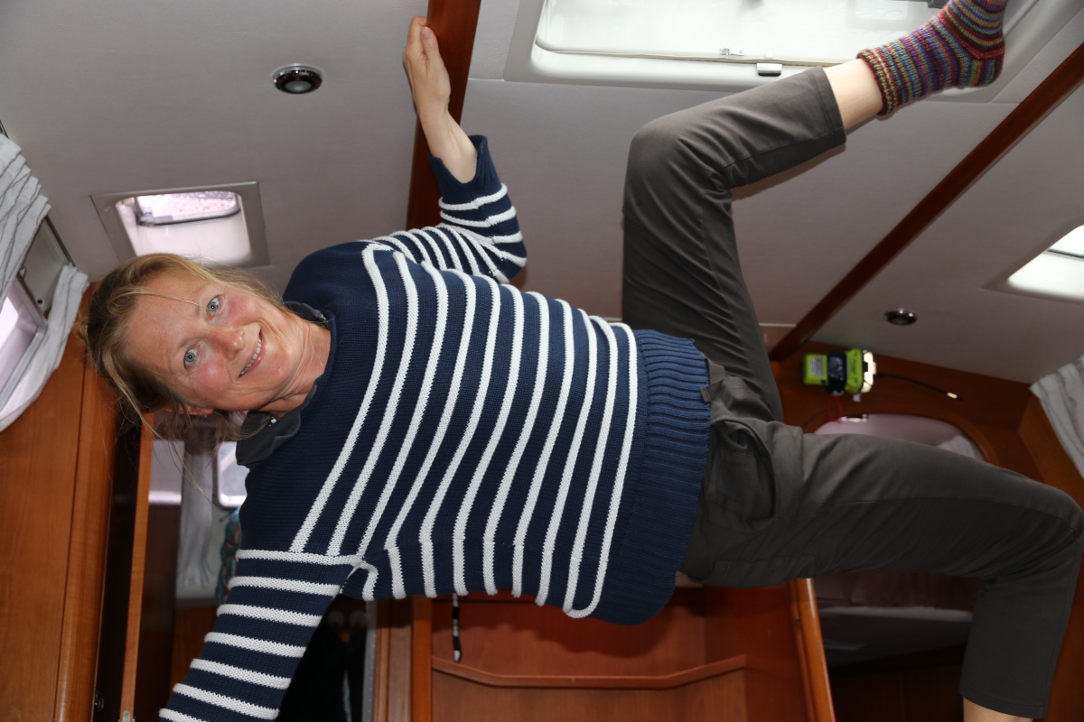
 Later, we walked through the village and found a hiking track leading up the mountain along an enormous waterfall. The water produced a strong, continuous wind stream along the fall. When the slope got too steep for our sneekers we had to turn around and head back. In the village we met a Danish man who had lived in Granvin with his wife and his son for seven years. He told us about the changes, the village had undergone in the past years and about the worsening financial situation of Norway with the current low oil prices. To my opinion this represents a crisis on a very high level, and he agreed. We had salmon with potatoes for dinner and Kirsten had a piccolo-bottle of sparkling wine.
Day 25 – Granvin to Langvag/Bømlo – 75 nm
The alarm went off at 5:10 h and we left short after 6:00 h in no wind. It was 4°C and we wore all we had, layers of clothes, foul weather gear, three caps, scarf and boots. We closed the companionway and turned on our heater. Since five days we had not seen another sailing vessel on the water and the only boats around us this morning were two high-speed catamaran ferries and the ferry in Jondal. Again, the head wind was up to 18 kn at the exit of the Granvin sound but soon decreased to 5 kn after a few miles. The sun appeared between the scattered clouds and the near-frost temperatures rose to some 11°C. Fortunately, today the current was in our direction. We had a quick stop in the nice village of Jondal to fill up our tank with 160 l of diesel fuel.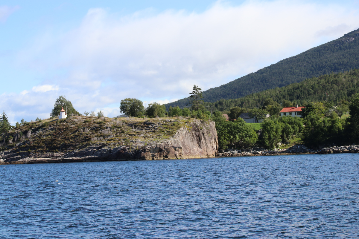 Since the wind had decreased even further we motored our way through the calm fjord and enjoyed the final vies of mountains,
 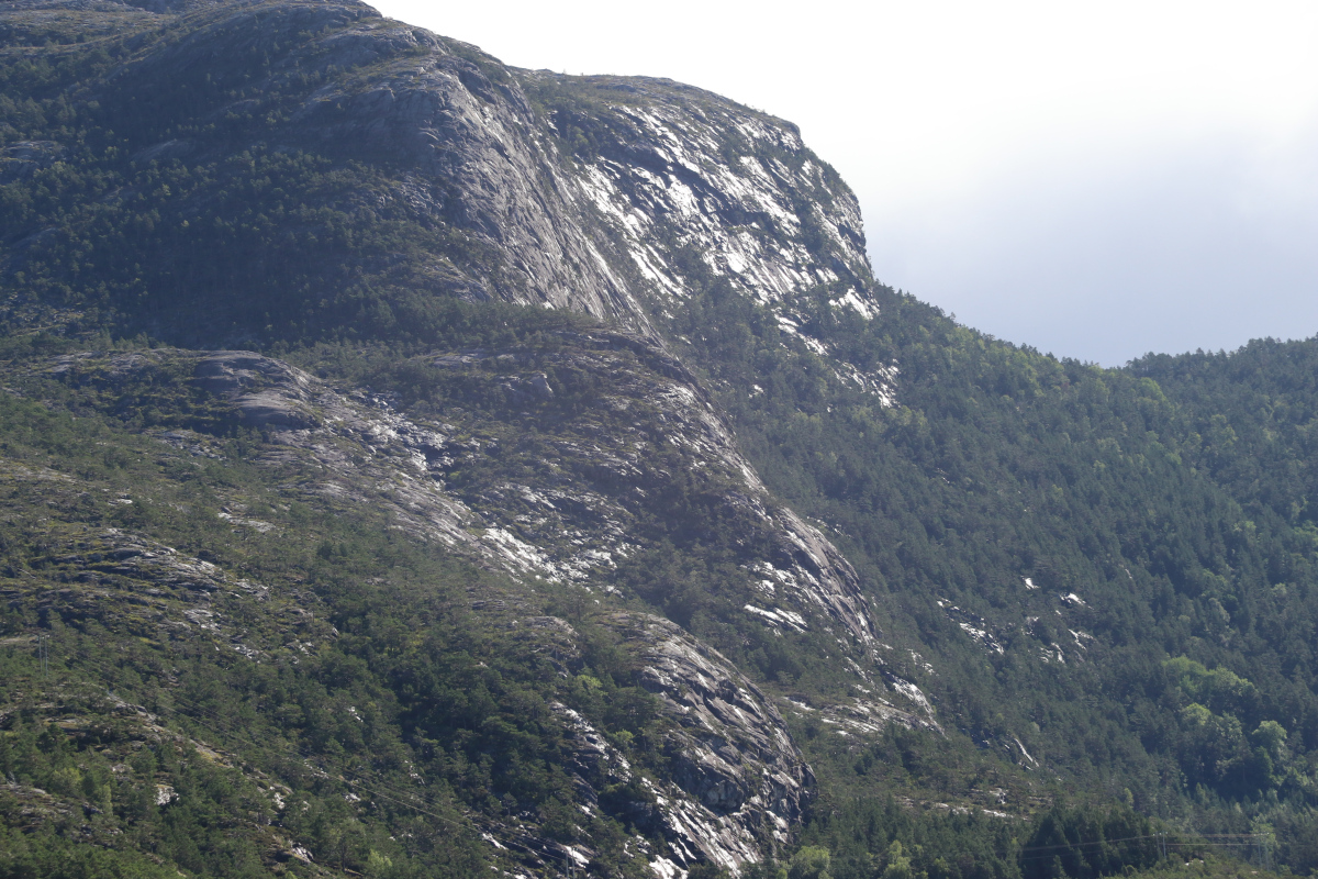 the snow fields and the Folgefonna glacier.
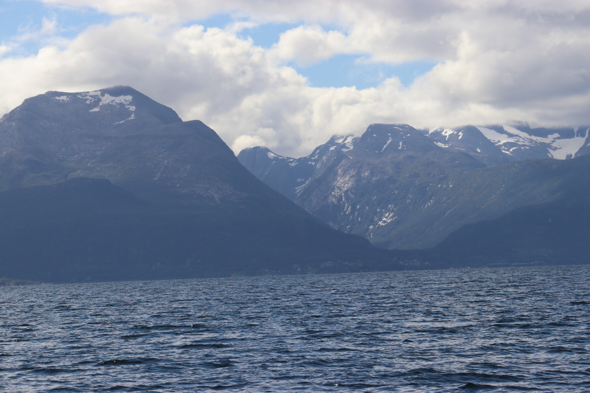
The wind picked up to 22 kn, gusting to 30 kn. We had a fast sail with a max. speed of 9,6 kn down the Hardanger with the main in the first reef and the genoa furled in to about 50%.
Kirsten was under deck most of the time and I froze to the bone. The intermittent rain showers did not enhance my comfort. We took down the sails in the entrance of Langevåg and Kirsten docked EASY like a boss and I curled our lines to dry out on deck. 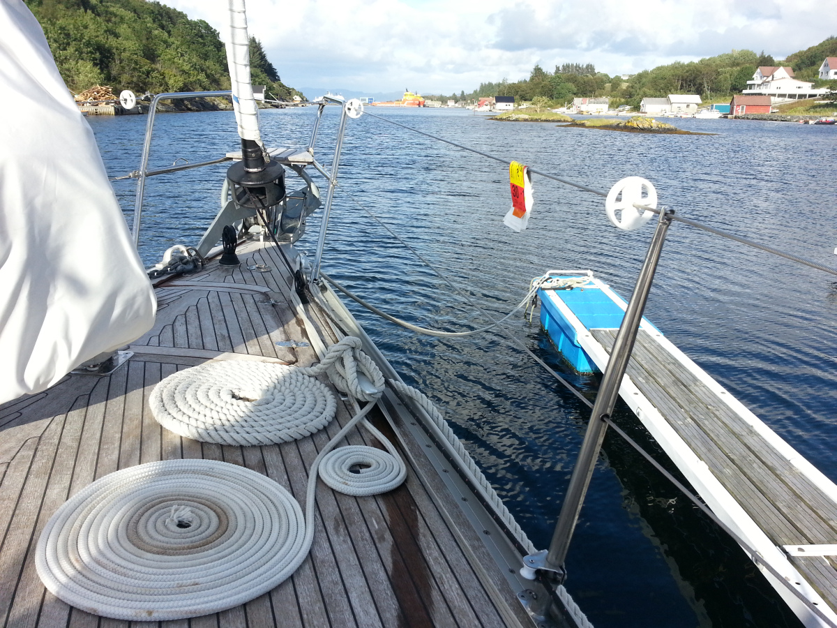 I went to bed early to prepare for our early departure the next morning.
Day 26 – Langvåg/Bømlo to Egersund 94 nm
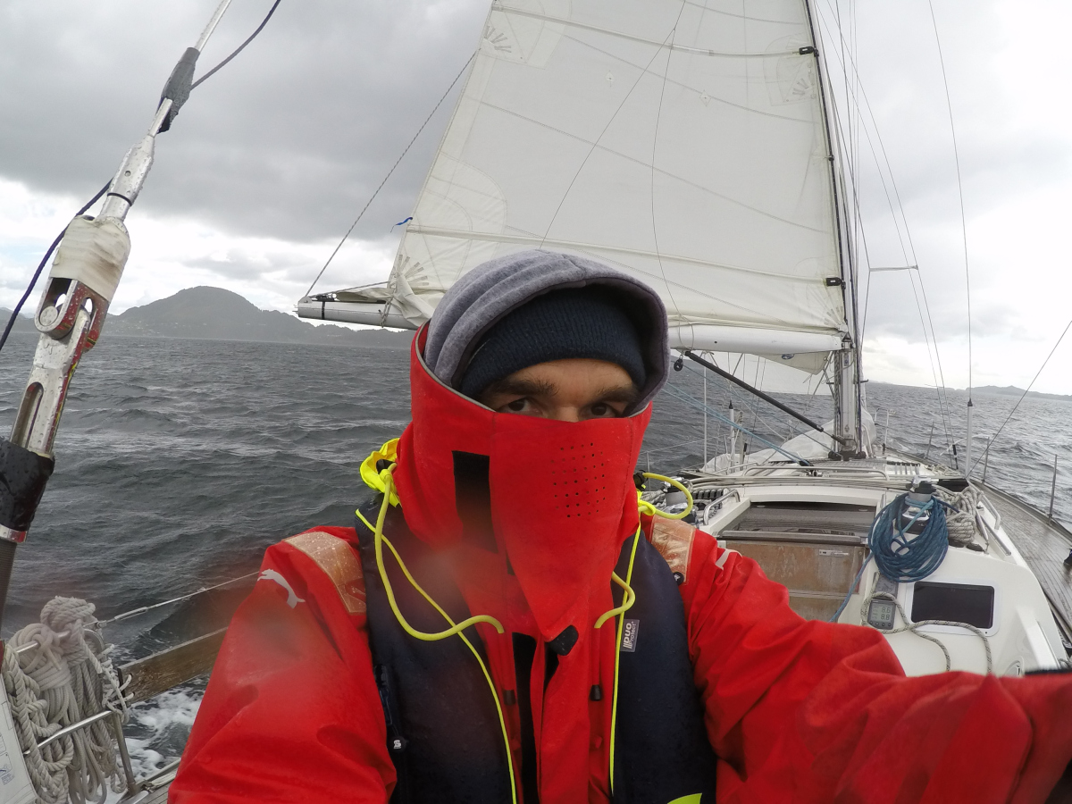
Again, the alarm went off at 5:10. The sea was dead calm, reflections on the water and the moving dusk on the water surface were the requisites for a horror movie.  We motored all day since the weather forecast showed an extensive period of easterly winds for the next week which would have made it difficult for us to cross the Skagerrak. It was chilling cold during the first four hours but at the entrance of the Hardanger a lot of traffic required me to control the helm, standing in the cold wind.
The heater was on to warm us up under deck when there were no other ships around. Again, we saw dwarf whales at three different places. Many sailboats were motoring along the coastline since the weather forecast for Friday, was wind up to 25 kn and heavy rainfall. In the afternoon I noticed that my G&G plotter started to show white squares along the edges of the display. I took some photos and sent a mail to the dealer. Also, the SailSteer Overlay feature did not work. I hope, B&G will fix these issues and supply a display that lasts longer than just one season. Note the water temperature of 12,6°C!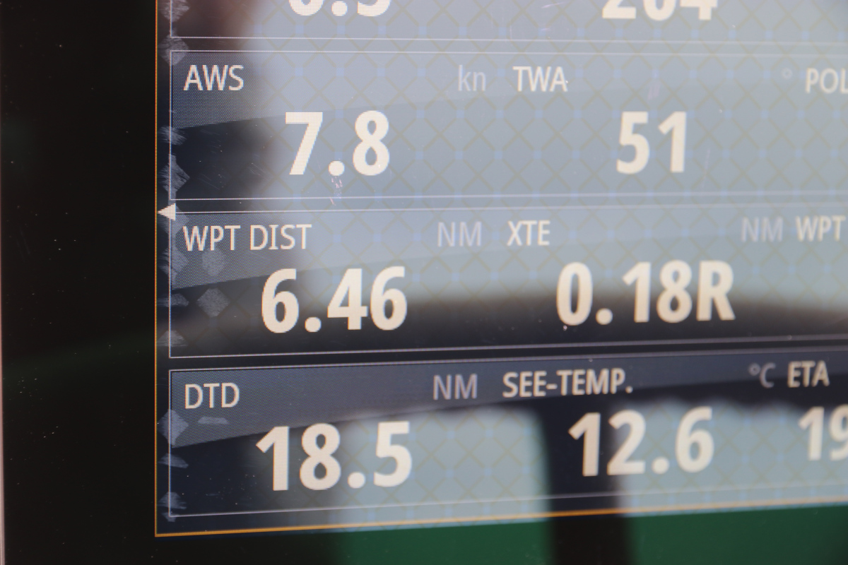 The entry of the Egersund was very nice, in strong contrast to the guest bridge and the town of Egersund. We could just pass the bridge over the sund which has a height of 22 m and I slowed EASY down so I could just steer her in the strong current and it looked as we nearly scratched the structure under the bridge. We saw several nice anchorages but decided to berth in town because of the forcast of heavy and prolonged rainfall. With 250 Norwegian Krones it was the most expensive berth so far, despite being so unattractive.
Day 27 – Caught in the rain in Egersund
We had the first shower since days and spent the day reading and backing up our stocks of milk, yoghurt, fresh salmon, bread and sweets. We walked through the town in continuous rain with the few shops closing at around 16:00 h. The Fayencemuseum in the shopping mall also did not arouse my interest. So it remained a day of not doing anything productive.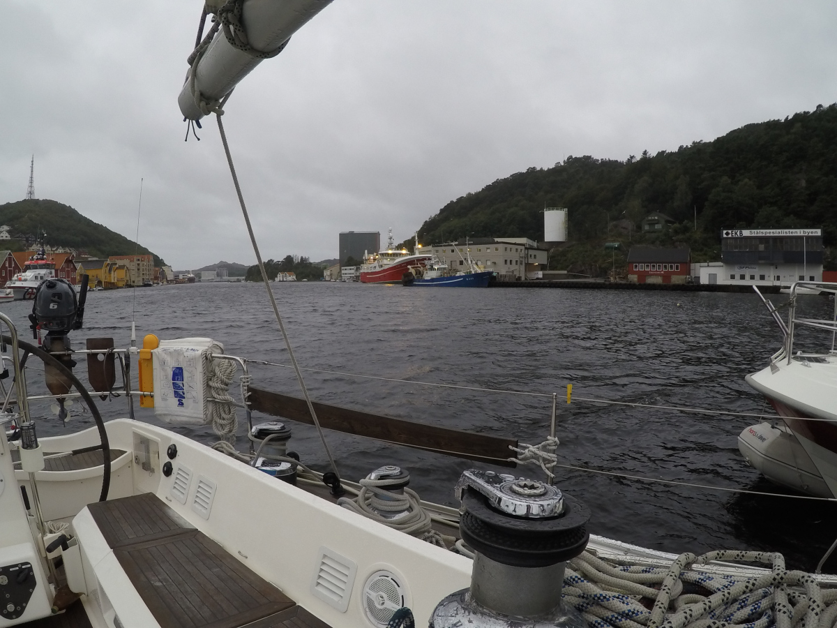
In the evening we had a nice meal of fried salmon with rice. Then we read about whaling and found that Norway and Island are the only countries worldwide that do not accept the moratorium of the IWC (International Whaling Commision) 1986 to ban commercial whaling internationally. Norwyay kills some 500 to 700 whales every year for commercial reasons. We learned that these are Northern Minke Whales (Balaenoptera acutorostrata), that reach a size of 8-10 m. This is the link to the Wikipedia graph citing official Norwegian statistics:
https://en.wikipedia.org/wiki/Whaling#/media/File:NorwegianWhaleCatches.png
There are exeptions to the moratorium to allow whaling for indigenuous tribes or for scientific reasons (whichever these might be). Japan and Iceland kill whales for scientific reasons to circumvene the moratorium. Other countries who kill whales are Canada, the Faroe Islands, Greenland, Indonesia, the Phillipines, Russia, Saint Vincent and the Grenadines, South Korea and the United States.
Stop Whaling, Norway!
We ended our day studying the weather forecast and making plans for the next day.
Day 28 – Egersund Kirkehavn/Hidra Island – 31 nm
We attempted to reach Kristiansand but half an hour motoring against the cold, pouring rain lowered our spirits below zero. This matched the sensed temperature. Egersund, gave us a disgusting farewell when the scent of foul fish became unbearably intense when we left the harbour. I do not want to know what they do to the poor creatures here to produce such an incredible smell. After an hour or so Kirsten sought shelter below deck and I fought my way through the high waves. Since swell and wind waves came from one direction I could even sail with the furled-in genoa after we altered our course along the coastline.
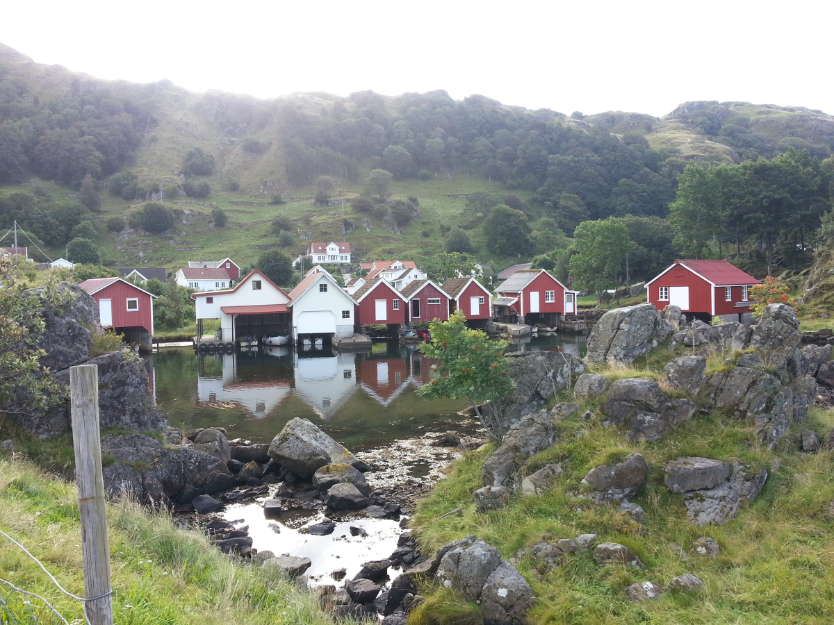
After four hours we were fed up and decided to enter the Fleckefjord once again. This was one of our best decisions on the Norwegian part of the trip. On passing the island of Hidra I turned right and said to Kirsten “Let’s just see what it looks like around this corner”. We entered the secluded Bay of Kirkehavn. You enter this landscape through a wide passage and can see a nice white church on a hill as first sight of the small village. Then the water separates into a variety of calm small bights with nice houses most of them with their own wooden pier.
After having set foot on firm land after this short passage Kirsten had decided to cross the Skagerrak by ferry and let me do the passage singlehanded. I was so disappointed after this message that I could not even talk and went to bed in the early afternoon since we had an early start at 6:00 h this morning and I was so exhausted.
Luckily Kirsten had found a washing machine and tumble dryer on land and got distracted by doing our laundry while I was asleep. Sleep and laundry had a very soothing effect on our minds and we had a superb time on the island.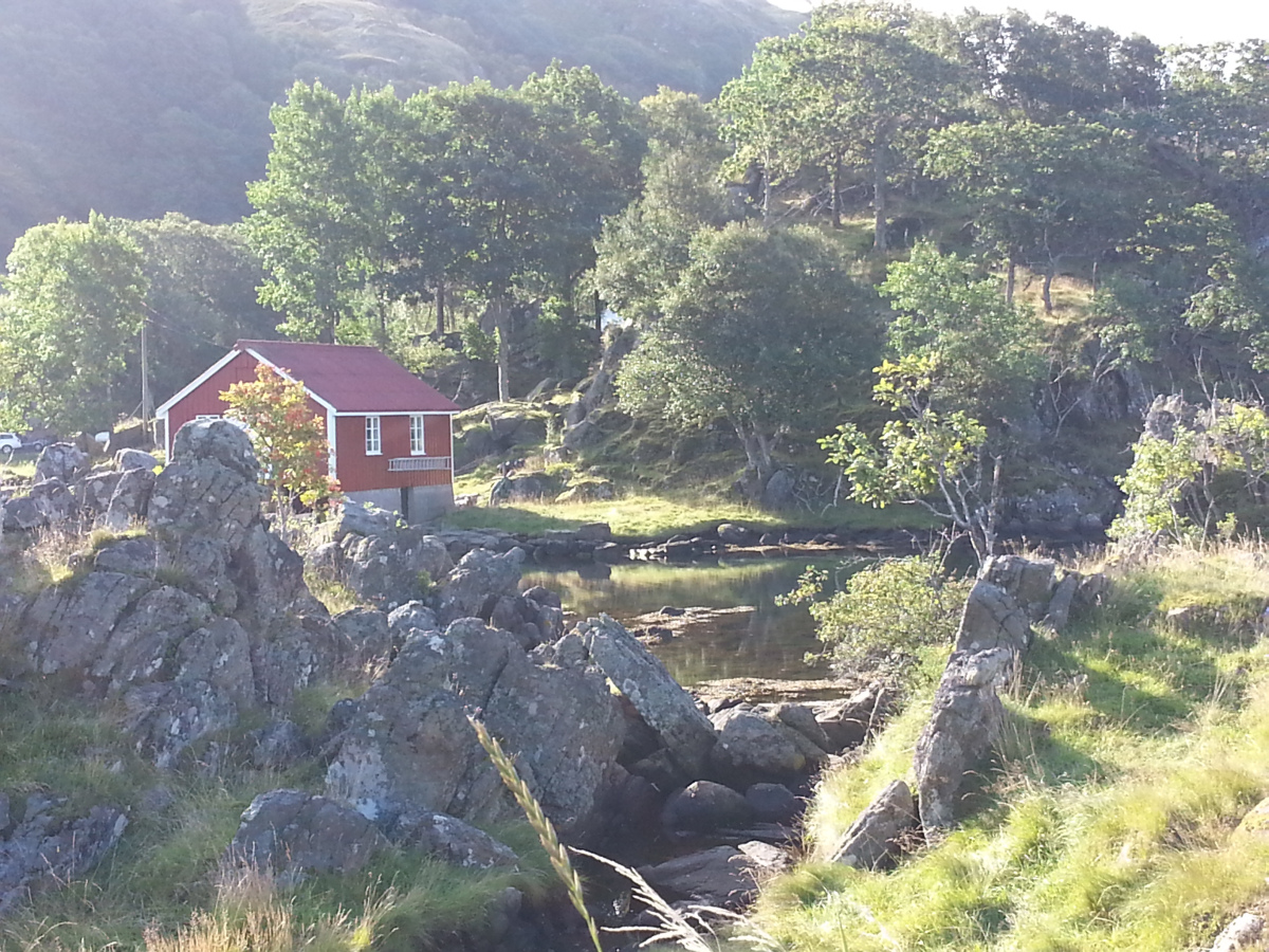
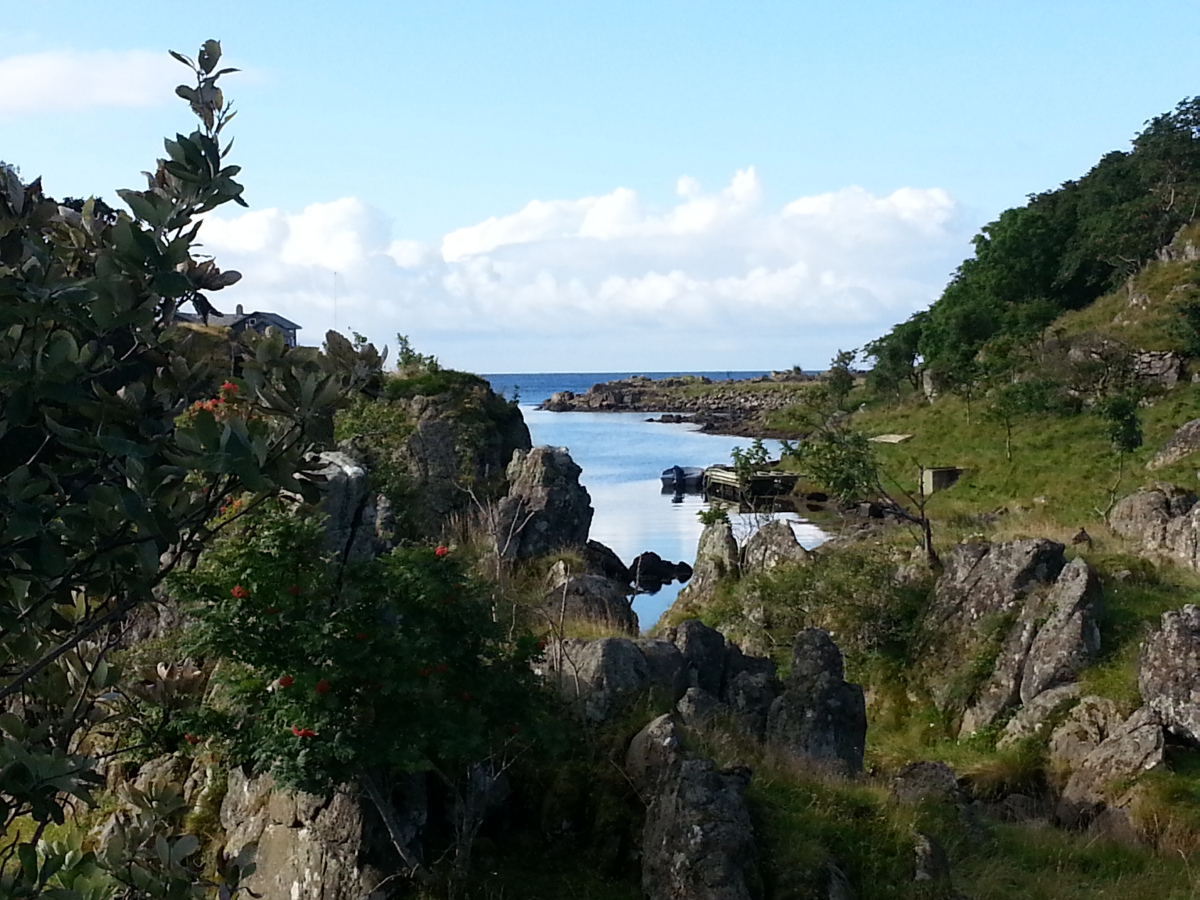
The parts of the set of small islands are connected by bridges over clear water with lots of fish and shells. 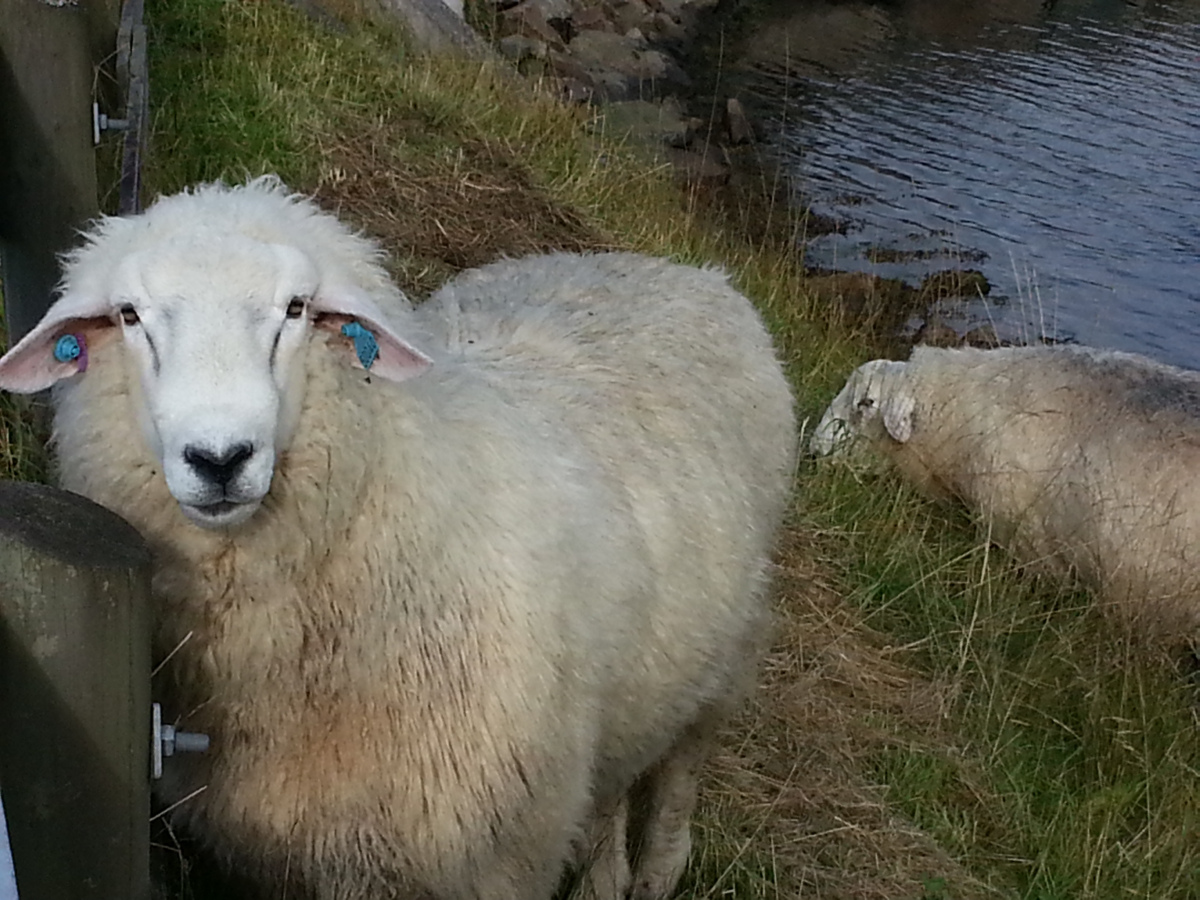 Sheep are bleating on the small mountains and the background of the landscape is created by mountains up to 200 m high with steep flanks. To even intensify our attraction to this place the weather improved, the rain stopped and we saw some sun. Only the water temperature of 15°C still did not invite us to go for a swim.
We certainly would have stayed for a couple of days longer if the weather forecast had not shown a phase of one week with easterly winds, beginning in two or three days. So we decided to head back to Denmark in smaller steps of up to 60 nm via Kristiansand, Hirtshals, Skagen.